Registration is open for the Online Workshop.
Machine Learning (ML) for Landslide Prediction Mapping with RStudio and ArcGIS
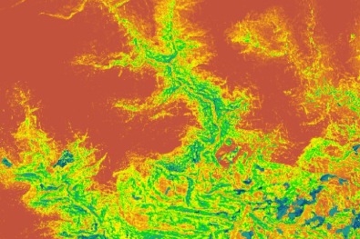
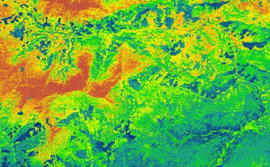
Join Us for 'Machine Learning (ML) for Landslide Prediction Mapping with RStudio and ArcGIS'. Our workshop is your gateway to a comprehensive exploration of landslide prediction mapping, leveraging the formidable capabilities of RStudio and ArcGIS. From mastering the basics to harnessing advanced techniques, this immersive journey promises hands-on experiences at every turn.

ABOUT Online Workshop
Join our Online Workshop: Machine Learning (ML) for Landslide Prediction Mapping with RStudio and ArcGIS.Unlock the world of machine learning and geospatial analysis as we guide you through a comprehensive journey in this workshop. Covering a wide spectrum of topics, this workshop is designed to provide you with practical knowledge and skills that can be applied to real-world challenges in landslide prediction mapping.In Module 1, Start with machine learning foundations, history, terminology, and core components. Explore techniques, practical applications, and distinctions from traditional programming. Understand common algorithms, the machine learning workflow, and future trends.Module 2: Focus on data preparation and exploration, including data collection, preprocessing, exploratory data analysis for geospatial data, and spatial data handling.Module 3: Enhance prediction accuracy through feature selection and engineering strategies.Module 4: Build Random Forest and Support Vector Machine models in model selection and training.Module 5: Learn model evaluation, prediction, assessing performance, and spatial visualization.Module 6: Discover model refinement techniques, including hyperparameter tuning and feature engineering.Module 7: Bring it all together by training the final model, generating susceptibility maps, and effective visualization/reporting.This workshop is an opportunity to acquire a comprehensive skill set that bridges the gap between theory and practical application, empowering you to excel in the field of landslide prediction mapping using RStudio and ArcGIS. Join us for this engaging and informative journey into the world of machine learning and geospatial analysis.
- 1. Introduction to Machine Learning
- 2. Historical Perspective
- 3. Essential Terminology
- 4. Core Components of Machine Learning
- 5. Machine Learning Techniques A to Z
- 6. Comparison with Traditional Programming
- 7. Practical Applications
- 8. Challenges and Limitations
- 9. Common Machine Learning Algorithms (Linear Regression, Random Forest, Support Vector Machines, k-Nearest Neighbors)
- 1. Data Collection Strategies
- 2. Data Preprocessing Techniques
- 3. Exploratory Data Analysis (EDA)
- 4. Spatial Data Handling and Preparation
- 1. Strategies for Feature Selection
- 2. Techniques for Feature Engineering
- 1. Building a Random Forest (FR) Model
- 2. Constructing a Support Vector Machine (SVM) Model
- 1. Making Predictions
- 2. Assessing Model Performance
- 3. Spatial Visualization of Results
- 1. Optional Hyperparameter Tuning
- 2. Iterative Feature Engineering
- 1. Training the Final Model
- 2. Generating Landslide Susceptibility Maps
- 3. Visualizing and Reporting the Findings
Primary Trainer
Primary Trainer Mr. Sujit Kumar Roy is a Research Assistant at GAZI GROUP. He has over 5 years of working experience in the field of EIA, RS and GIS for different national (Government) and international projects as post of GIS analyst at Suchana Engineers Limited, Research Assistant at IWFM, BUET, Research Fellow at RAiN Forum, Junior Environmental Expert at Plan Plus Limited (PPL). He is currently pursuing a Post-Graduation in Water Resources Development from IWFM, BUET, Bangladesh and has a Bachelor’s degree in Environmental Science and Disaster Management from Noakhali Science and Technology University (NSTU). Furthermore, he is an independent researcher with a variety of software experts who have published several scientific articles in internationally renowned journals highlighting his areas of interest, which include RS and GIS, Hydrology, Time Series, Natural Hazards, Coastal Zone Management, Machine Learning, and Deep Learning. He is engaged in different environmental research and its advancement.
Trainer
Training Benefits
- Gain hands-on experience in using both RStudio and ArcGIS for landslide prediction mapping.
- Acquire the knowledge and skills necessary to predict and map landslide susceptibility accurately.
- Harness the power of machine learning to address real-world environmental challenges.
- Network with fellow professionals and researchers in the field.
- Instructors continuous support, taking your hand step-by-step to develop high-quality prediction maps using real data
- Live WhatsApp Chatting with instructor
- Unlimited 1:1 Sessions with experts
- Lifetime subscription
- Any time watch recorded video
- Easy Payment Gateway such as Debit card, credit card, UPI etc. (international payment also acceptable)

Ready to enroll Online Workshop?
Machine Learning for Landslide Prediction Mapping with RStudio and ArcGIS
Machine Learning for Landslide Prediction Mapping with RStudio and ArcGIS
Why Learn With us?
Over two decades of experience and expertise in teaching Tech and coding helping students develop their tech skills for higher performance, better careers and growth in companies.

Benefit of taking this course?
World Class Teachers
Get certified with our premium courses and get started on your journey to a brand new career altogether
Certifications
Get certified with our premium courses and get started on your journey to a brand new career altogether
Students Community
Get certified with our premium courses and get started on your journey to a brand new career altogether
Live session
Get certified with our premium courses and get started on your journey to a brand new career altogether